OpenFreeMap

OpenFreeMap – Open-Source Map Hosting lets you display custom maps on your website and apps for free.
Who is behind this project and how can I follow it?
I’m Zsolt Ero (blog, email).
After 9 years of running my own map tile infrastructure for MapHub, I’ve open-sourced it and launched OpenFreeMap.
X: @hyperknot (for details)
X: @OpenFreeMapOrg (for announcements)
GitHub: openfreemap and openfreemap-styles
Barely Maps

Minimalist maps by Peter Gorman.
A few years ago, I took a one-year, solo bicycle trip around the U.S. and Canada. I rode over 11,000 miles in one big loop.
After the trip, I designed some graphic maps inspired by the places I visited, and opened an online shop called Barely Maps.
Historical map of Schenectady County in the State of New York - David Rumsey Historical Map Collection
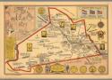
Conde, Edwin G.; Historical map of Schenectady County in the State of New York. Compiled and drawn by Edwin G. Conde 1931, Lithographed in Schenectady by Litto Craft. Copyright, 1931, by Edwin G. Conde. (insets) Map of old Schenectady. (with) Under three flags.; 8468.000; Detailed historical pictorial map, with title cartouche. Shows major bodies of water and rivers, railroads, places and buildings with emphasis on historical events, which are labeled throughout, lines indicating the roads, and historical routes. Includes notes on "Historical markers", County and city seals, Compass rose, and portraits of Lieut. Col. Christopher Yates, Joseph C. Yates, George W. Featherstonhaugh, and De. Eliphalet Nott.
Atlascope Boston · Historic urban atlases from the Norman B. Leventhal Map & Education Center
National Geographic Has Digitized Its Collection of 6,000+ Vintage Maps: See a Curated Selection of Maps Published Between 1888 and Today | Open Culture
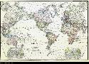
As some of the finest fictional world-builders have understood, few things excite the imagination like a map. And despite the geographical limitation implied by its title, National Geographic’s maps have surveyed the entire globe and beyond. The magazine’s articles have not always presented an enlightened point of view, but for all its historical failings, the richly-illustrated monthly has excelled as a showcase for cartography, over which readers might spend hours, projecting themselves into unknown lands, journeying through the carefully-drawn topographies, cityscapes, and celestial charts.